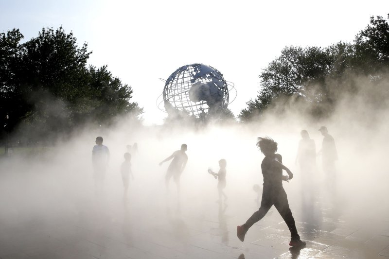
People cool off in hot and humid weather at the mist garden near the old World's Fair Unisphere in Flushing Meadows-Corona Park in New York City last August. File Photo by John Angelillo/UPI |
License Photo
High temperatures ranging from the upper 80s to the mid-90s are on the way for close to 100 million people in the Northeast this weekend as stifling heat typical of the middle of summer will be felt from Ohio to North Carolina and Maine.
In many areas, the heat and humidity this Saturday and Sunday will bring the hottest conditions since last August, and in some locations, record highs that have stood for more than 100 years could be broken, AccuWeather meteorologists say.
Daily record highs that have stood since the World War II and Great Depression eras will be challenged at a number of locations. At Philadelphia, temperatures could approach the record of 95 set in 1934 on Saturday. In both Raleigh, North Carolina, and Albany, New York, the daily records for Saturday, May 21, were set in 1941. The record in Raleigh is 96, while the record in New York's state capital is 91.
In a few cases, the heat could be the most intense since the summer of 2020. The predicted high in Richmond, Virginia, on Saturday is 98. The highest temperature in Virginia's capital city during the summer of 2021 was 96 F in June and July.
The last time the thermometer there had readings in the upper 90s or higher was on July 28, 2020, when the high topped out at 101.
Similarly, the last time Pittsburgh recorded temperatures that are currently forecast for Saturday was two summers ago on Aug. 25, 2020. Temperatures are forecast to hit 93 on Saturday, which would break the daily record of 92 that dates back more than 100 years ago to 1911. A temperature of 92 degrees was recorded last on June 28 and 29 in the Steel City.
When combined with surging humidity, strong May sunshine and other factors, AccuWeather RealFeel® Temperatures will approach dangerous levels from near to above 100 for several hours during the midday and afternoon hours on Saturday.
Weather conditions have ranged from stormy to less than ideal in coastal areas of the mid-Atlantic during the past two weekends, but for those who have been yearning for a weekend getaway at the beach and a way to beat the heat, Friday, Saturday and Sunday could be good days to do so from North Carolina to New England.
Predicting temperatures within a few miles of the Atlantic Ocean or its bays and estuaries can be tricky during the spring and early summer, forecasters say. The chilly water can hold temperatures back by a few to a dozen or more degrees, provided a sea breeze develops. In some cases, it can get chilly right along the beach due to the persistent winds.
On Saturday, temperatures are likely to surge quickly during the midday hours but may fall back a bit during the afternoon, in locations where a sea or bay breeze develops. Atlantic City, New York City and Boston are among some of the population centers that could experience local cooling effects from the water later Saturday.
Experts say those heading to the beaches this weekend should be mindful of the water temperatures, which are currently far from midsummer levels, and will also need to be mindful of the dangers of cold water shock.
Ocean water temperatures in Northeast coastal waters are still chilly during the second half of May. Surf temperatures this week range from the icy 40s along the southern Maine coast to the cold 50s from the southern New England and New Jersey beaches to the chilly 60s from Maryland to Virginia. Water temperatures consistently in the 70s are not found until the Outer Banks of North Carolina.
Another hazard some beachgoers may face this weekend is damage from the barrage of rough surf earlier in May. The same storm that brought two days of rain during the Mother's Day weekend spent the following week lingering just offshore. While the storm did not evolve into a tropical system, stiff northeasterly winds from the storm set up a chain reaction that resulted in powerful waves tearing into the sand on many beaches.
Residents in the Northeast will also need to be alert for developing thunderstorms this weekend.
"Very warm and muggy conditions are in store Saturday night, and that will set the stage for hot and humid conditions on Sunday along much of the Interstate 95 corridor, despite increasing cloudiness produced by the approaching cool front from the Midwest," AccuWeather Lead Long-Range Meteorologist Paul Pastelok said.
As that front approaches, showers and thunderstorms can occur at any time on Sunday over the Appalachians and eastern Great Lakes region.
Spotty thunderstorms may affect parts of northern New York and New England during Friday night and Saturday, but the majority of thunderstorms should hold off for the balance of the Northeast until Sunday and may not reach southeastern New England and the mid-Atlantic coast until Sunday afternoon or evening.
The storms that cut into the heat later in the weekend could become severe and bring the risks of locally strong winds, flooding downpours and hail.


